Eastern Sierra Fishing Map
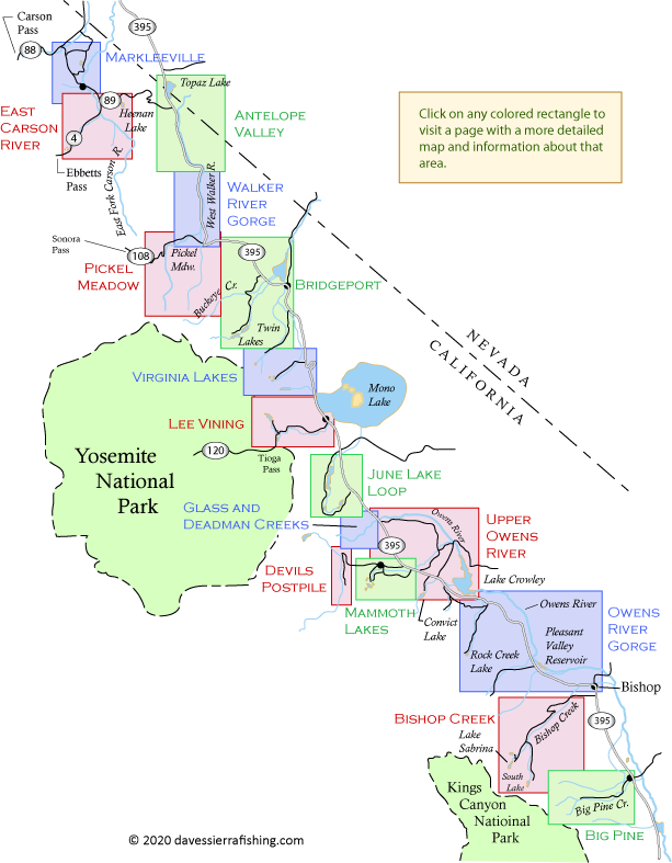
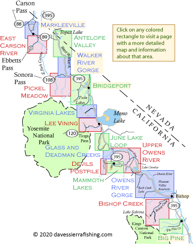
Maps of the Eastern Sierra Nevada
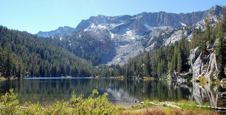
The Eastern Sierra has become one of the most popular fishing destinations in the country. While anglers flock to places like Twin Lakes, the Owens River and Hot Creek, other less-well-known fishing waters in the Eastern Sierra can be equally as rewarding. These maps of the Eastern Sierra cover fishing waters from Markleeville in the north all the way south to Big Pine Creek.
Each of the Fishing and Camping Maps shows rivers and streams, lakes, cities, major roads and trails, and camping places. Some outlying resorts are shown, but not those in cities. Every effort is made to keep the information up to date, but changes can occur without notice. Before setting out on your fishing outing you would be wise to check current state fishing regulations. If you are planning on camping, it is advisable to check the appropriate government agency's website for the latest campground conditions.